
Click the link below the picture
.
The latest bout of brutally cold weather that has beset the eastern U.S. for weeks sent wind chills into the negative teens and 20s Fahrenheit (negative mid-20s to negative low 30s Celsius) in the U.S. Northeast over the weekend. Meanwhile, out West, winter has brought record-breaking warmth that is more suited for spring and even summer. “I’m sitting here in a T-shirt in early February, a mile high in Colorado,” says climate scientist Daniel Swain of the California Institute for Water Resources.
This stark disparity is the product of a persistent atmospheric pattern. That pattern is about to break, however, and the weather fortunes of the two halves of the country are set to switch.
To explain what’s happening, let’s review a favorite winter weather bugaboo: the polar vortex. The vortex is like a circular rushing river of wind that corrals the bitterest cold air up in the Arctic. When the vortex weakens, that tight circle becomes wavier, akin to how a slow-moving river tends to meander in bends across the landscape, Swain says.
Where the vortex bends southward, cold air follows. And if it bends southward in one spot, it must bend northward in adjacent areas. In this case, the northward bend is happening over the western U.S., where it has pulled up warmer air.
Those bends tend to be set up in ways that reinforce background conditions related to Earth’s geography, Swain says. In the case of the U.S., the location of the Rockies, as well as the boundary between the Pacific Ocean and the land, means that, on average, a weak ridge (a northward bend in the jet stream) forms over the West and a weak trough (a southward bend) establishes over the East. The present dichotomy “is an amplification of that background pattern—a dramatic one,” Swain says.
The rapid warming of the Arctic may be making such weakening of the polar vortex more common, but researchers aren’t yet sure. “To the extent that it’s doing so, it hasn’t been enough to overcome the fact that that source of bitterly cold air isn’t as bitterly cold as it used to be,” Swain says.
This effect bears on the current situation. For the period of December 2025 to January 2026, no part of the contiguous U.S. had record cold. But 21 percent of the country had the warmest such period since 1940, according to climatologist Brian Brettschneider.
And as winters get warmer overall, these bouts of bitter cold become more disruptive because they are so unusual. People are less acclimated to freezing weather, and businesses may not make contingency plans. “For someone who is 25 or 30 years old, they may have had the coldest week in their life,” Swain says, whereas, for those out West, “it’s been the warmest winter regardless of age.”
Though the consequences of the cold have been widespread and acute—with travel disruptions, power outages, and scores of deaths—the warm western winter will also take a toll. Its consequences, however, will be delayed, with the potential for drought, water shortages, and a higher risk of wildfires in the coming months.
The upcoming weather switch up likely comes down to a subtle atmospheric shift. Understanding the details would take a dedicated study to unpack all the influences, Swain says, but it could be a change in where storms in the tropical Pacific are occurring, which can knock things around in the atmosphere like dominoes. Whatever the cause, temperatures will rise to more seasonable levels in the eastern U.S., and cooler, wetter weather will come to the West. Any rain or snow will be welcome, Swain says, but will be unlikely to erase the current deficit.
.
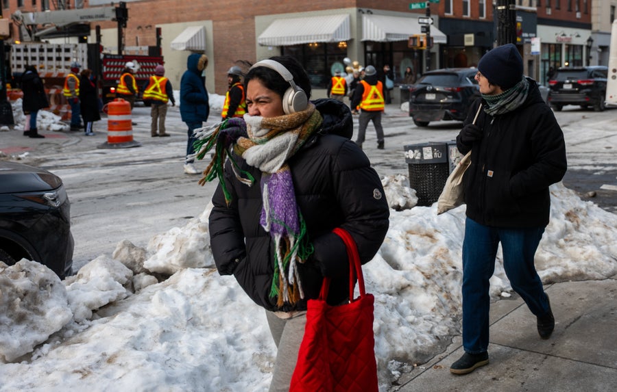
People walk down a street in Brooklyn, N.Y., on February 7, 2026, a day when an “extreme cold warning” was in effect. Spencer Platt/Getty Images
.
.
Click the link below for the complete article:
.
__________________________________________

Leave a comment