
Click the link below the picture
.
CLIMATEWIRE | Forecasters warned for days that Tampa could be staring down “the big one” — a direct hit from a major hurricane that threatened to submerge much of Florida’s second-largest metro area with never-before-seen storm surge.
The nightmare scenario didn’t happen. Hurricane Milton tracked slightly south of its worst-case trajectory, making landfall Wednesday night in Sarasota County. Storm surge, overall, was lower than the water levels driven by Hurricane Helene two weeks prior.
Yet it was still a record-breaking storm, dumping historic rainfall along the coast and spawning tornadoes that carved a path of destruction across multiple counties.
Scientists say climate change, including unusually warm waters in the Gulf of Mexico, likely worsened its explosive intensification into a Category 5 cyclone before it weakened and made landfall as a Category 3.
“What we can say is the storm was significant, but thankfully this was not the worst-case scenario,” Florida Gov. Ron DeSantis said at a press briefing Thursday morning.
Tampa was spared largely thanks to a southward wobble in Milton’s track in the final hours before landfall, sending the storm toward Sarasota.
That doesn’t mean projections by the National Weather Service were inaccurate, said Austen Flannery, a meteorologist with the National Weather Service’s Tampa office. Landfall still happened well within the forecast’s cone of uncertainty.
“Overall, the end result was relatively consistent with the forecast,” he said.
Preliminary estimates suggest storm surge was highest in Sarasota County, he said, likely around 8 to 10 feet. That’s significantly less than the 15 feet the National Weather Service had warned was possible for Tampa.
Yet widespread flooding still occurred across the state — partly from surge, but largely because of heavy rains.
Parts of Tampa were pelted with more than 10 inches of rainfall. Tampa International Airport recorded 11.73 inches, according to the National Weather Service. And the nearby city of St. Petersburg saw nearly 19 inches of rain, a monthly record.
“In two days, we had more rain than we’ve ever had in the month of October at that location,” Flannery said.
Strong winds also blasted the Tampa Bay region, downing trees and power lines, damaging homes and businesses, and ripping the roof off Tropicana Field, the stadium that’s home to the Tampa Bay Rays in St. Petersburg. Preliminary datasets from the National Weather Service report gusts of over 100 mph in parts of Tampa and Sarasota County.
Milton also sparked tornado outbreaks across the state, including at least 45 individual tornado reports and 19 confirmed touchdowns. The outbreaks triggered more than 100 tornado warnings across the state in a single day, a record for Florida, according to local meteorologists.
Scientists are still digging into the reasons Milton spawned so many twisters. Aspects of the storm’s track and motion across the Gulf and its interaction with other weather systems as it moved over Florida likely fostered favorable conditions for tornado formation.
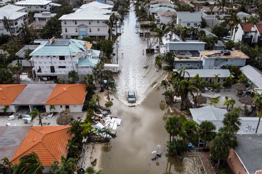
In this aerial photo, a vehicle drives though a flooded street after Hurricane Milton, in Siesta Key, Florida, on October 10, 2024. Chandan Khanna/AFP via Getty Images
.
.
Click the link below for the article:
.
__________________________________________

Leave a comment